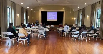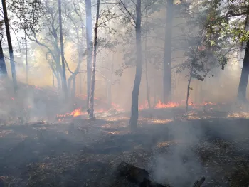
The following provides a brief follow-up on next steps to apply for an Ag Pass and some of the resources mentioned during the trainings, for your future use. The resources are helpful to any farming operation in its planning and preparation for wildfire, even if not applying for an Ag Pass.
For questions about the Marin Ag Pass Program, contact Kayla Friedrichsen with the Marin Agriculture Department at kfriedrichsen@marincounty.org or (415) 473-6700.
For questions about the trainings, contact Randi Black, UCCE Dairy Advisor, at rablack@ucanr.edu or (707) 565-2648. You can also contact Tori Norrville, UCCE Fire Science Advisor, at trnorville@ucanr.edu or 707-565-3443 for a site visit to discuss structure hardening, defensible space, emergency plans, and site-specific topography questions.
County specific steps for Ag Pass application
- Marin Producers: Marin County Department of Agriculture will be rolling out the online platform and providing notification for producers when applications can be submitted for consideration. This is anticipated for August, 2023. You will need the training certificate of completion you received at the training you attended as part of your application for the program. You will receive notification when your application and documents have been reviewed and approved.
- Sonoma Producers: Submit your application, including your training certificate of completion to the Sonoma County Agriculture Department for review and consideration, specifics are available here - https://sonomacounty.ca.gov/awm/agaccess. If approved, your information will be forwarded to Sonoma County Sheriff Department for completion and issue of your Ag Pass.
Ag Pass and Fire Safety Resources
- LCES explained – Lookouts, Communications, Escape Routes, and Safety Zones are the elements you need to consider and implement for your safety when using your Ag Pass - https://www.cpf.org/health-and-safety/wildland-firefighter-safety/lces.

- Incident Response Planning Guide - https://www.nwcg.gov/sites/default/files/publications/pms461.pdf.
- Ag Pass Overview: This factsheet provides an overview of Ag Pass programs - https://anrcatalog.ucanr.edu/pdf/8685.pdf.
- Fire Monitoring Resources
- USFS Incidents - https://inciweb.nwcg.gov/
- CALFIRE Incidents - This will tell you what Incident Management Team (IMT) is working the fire (to help find the right QR code). *Note* that sometimes smaller fires won’t have a Team that has a QR code. The CALFIRE IMT all have a QR code and get called on most large fires, but sometimes the smaller fires are handled in Unit (LNU or Marin County Fire), requiring an additional step to get the IAP info out from there if needed. https://www.fire.ca.gov/incidents/
- UCCE Fire Activity Map - This site will give you updated information pulled from the CALFIRE and USFS websites all in one place. Some of the larger incidents will have fire perimeters and hot spot information. This information may be outdated if the fire is growing or moving rapidly. Good to help determine where fire activity might be that day. https://ucanr.edu/sites/fire/Safety/Current/
- Alert California - Online California statewide network of fire observation cameras across, providing live feed observations. https://alertcalifornia.org/, https://cameras.alertcalifornia.org/?pos=37.2382_-119.0000_6 Examples include but are not limited to:
- Black Mountain - https://cameras.alertcalifornia.org/?pos=38.2096_-122.3657_10&id=Axis-BlackMtnMarin
- Mount Burdell - https://cameras.alertcalifornia.org/?pos=38.2096_-122.3657_10&id=Axis-MtBurdellSouth1
- Sonoma Mountain - https://cameras.alertcalifornia.org/?pos=38.2096_-122.3657_10&id=Axis-SonomaMt
- SARTOPO – This interactive map shows current fire perimeters along with wind (from current out to +36 hours). Fire perimeters may be outdated if the fire is growing or moving rapidly. Good to help determine where fire activity might be that day. https://sartopo.com/map.html#ll=38.64905,-121.92078&z=8&b=imagery&a=c%2Cmodis_mp%2Cwxd_wspd-01
- WatchDuty – free mobile app that can give you updates for fires near you.
- Maps and mapping resources:
- Marin County Maps - https://www.marinmap.org/Html5Viewer/Index.html?viewer=smmdataviewer
- California Wildfire History Map - https://projects.capradio.org/california-fire-history/#6/38.58/-121.49
- CalFire Fire Hazard Severity Zones - https://calfire-forestry.maps.arcgis.com/apps/webappviewer/index.html?id=fd937aba2b044c3484a642ae03c35677
- Weather Resources
- National Weather Service - https://www.weather.gov/
- Weather and Forecasting Resources – useful introduction and visuals for understanding weather and weather forecasting as it relates to prescribed and wild fires. https://storymaps.arcgis.com/stories/25fc708db9694ab68539038f2548ef6b.
- Windy – Very useful for wind directions and speeds, also available as a mobile cell phone application. https://www.windy.com/?60.802,-86.309,3
- Air Quality Resources
- For mobile devices: AirNow mobile app – free and available at Apple App and Google Play Stores
- AirNow – Useful for monitoring smoke, also available as a mobile cell phone application. https://www.airnow.gov/wildfires/when-smoke-is-in-the-air/#map.
- Smoke Forecast – USFS Interagency Wildland Fire Air Quality Response Program. https://outlooks.airfire.org/outlook.
- Purple Air – Provides real time air quality map. https://map.purpleair.com/1/mAQI/a10/p604800/cC0#8.31/38.45/-122.238/
